
Finding Bell Gardens Street Directory Leads
A Bell Gardens street directory search works best as a chain. The first result is a parcel, not a person. Keep the physical situs, legal land identity, and people-related clue separate.
- Address. Enter the physical address in the Los Angeles County Assessor Portal's Basic Search. The situs is the parcel location, not proof that a person lives there.
- AIN. Save the ten-digit Assessor Identification Number. Its 4-3-3 form translates map book, page, and parcel into a county record key.
- Deed clue. Record an ownership-event date, document number, type, or reason. The RR/CC index then uses grantor, grantee, and recording year, not street address.
- Voter limits. The county verifier checks only the requester's own registration with last name, birthdate, house number, and ZIP. A street index needs a qualified purpose, contract, and fee.
- Criss-cross. Ask library or Norwalk staff for a qualifying address-to-occupant volume, check its geography and dates, and pair any hit with another dated source.
An owner, mailing recipient, or printed entry is not certain proof of current occupancy.
Bell Gardens Assessor Address Search
The Los Angeles County Assessor Portal is the free address and AIN starting point for Bell Gardens. It offers address, legal-description, and map paths, but no unrestricted owner-name browse. Deployed labels did not expose a current owner name or tax mailing address, so a parcel result does not prove occupancy.
Basic Search accepts address or AIN; Legal Search uses the assessment description; Map Search helps when autocomplete fails. The 4-3-3 AIN links parcel, assessment, recorder, and tax clues.
Open the Los Angeles County Assessor Portal address and AIN interface for the county search surface.
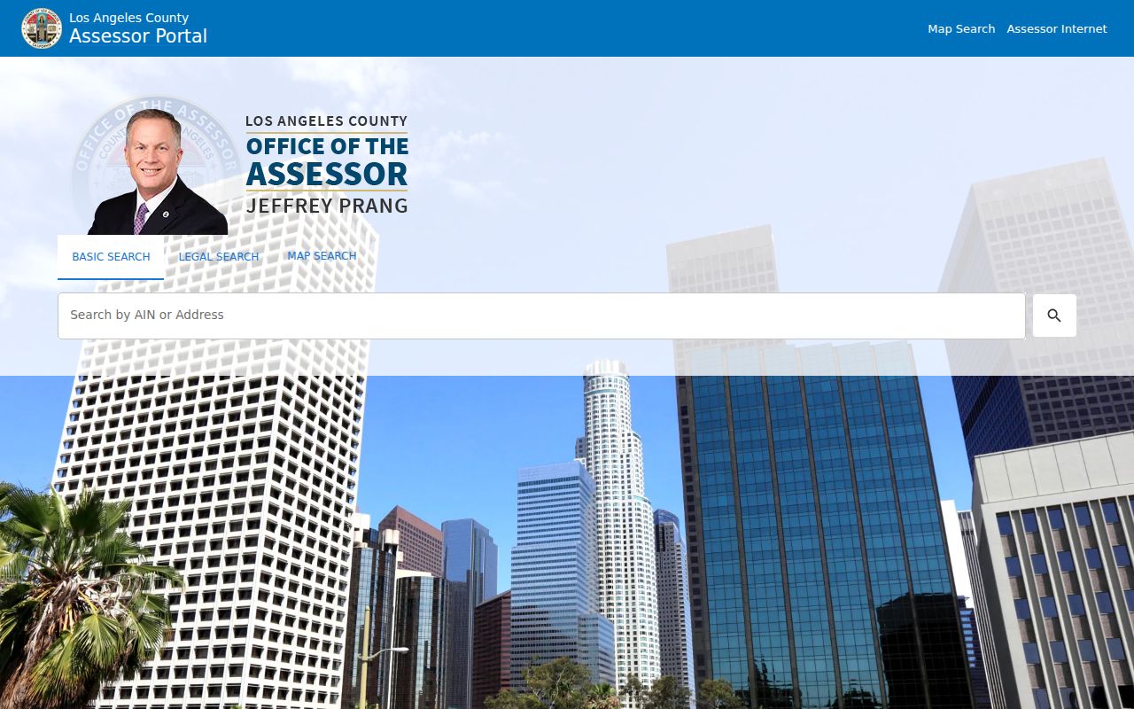
The actual parcel result remains the controlling record for each address checked.
| Assessor field/control | Type | Required | Notes |
|---|---|---|---|
| Basic Search | Tab | Choice | Choose AIN or Address. |
| AIN | Text field | Alternative | Find AIN, using ten digits in a 4-3-3 display. |
| Address | Autocomplete | Alternative | Physical or situs address. |
| Legal Search | Tab and form | Alternative | Search the assessment legal description. |
| Map Search | Map and tab | Alternative | Pan, zoom, click the polygon, then use Get Parcel Detail. |
| Map layers | Checkboxes or menu | Optional | Parcels, cities, communities, ZIP, TRA, districts, aerial years, and more. |
Note: The public Assessor result can connect a situs address to an AIN, but it does not prove that any named person lives there.
Browse Bell Gardens Streets by Parcel
The Los Angeles County Assessor Parcel Viewer changes one address into mapped lots. Pan to the Bell Gardens address, turn on Assessor Parcels, click the polygon, choose Get Parcel Detail, and save the AIN and situs. Repeat because adjacent parcels do not always follow house numbers.
Open the Assessor Parcel Viewer map for Bell Gardens street and adjacent-lot research to inspect the parcel-browse surface.
The map supports parcel selection, not an owner or occupant roster. For an immediate block, click polygons left, right, rear, and at corners, then work clockwise. No verified resident-radius search was found.
Layers include Cities, Communities, ZIP, Tax Rate Area, districts, street labels, map books, PLSS, and aerial views from 2008-2023 plus selected 2024/2025 years. The zoning layer is unincorporated, so city zoning belongs with Bell Gardens Planning.
Note: Map adjacency is stronger than consecutive house numbers when a street search needs every parcel, including a rear or corner lot.
Bell Gardens Address Record Coverage
No Bell Gardens address directory contains every fact. This coverage table shows each source's address or street mode, useful evidence, and stopping point.
| Source | Address or street capability | What can appear | Critical limit |
|---|---|---|---|
| Assessor Basic Search | Address or AIN | AIN, situs, use, physical, value, event | Free; no owner-name browse found |
| Assessor Parcel Viewer | Pan and click parcels | Boundaries, AIN, detail, layers | No owner or occupant roster |
| RR/CC Recorder index | Names plus recording year | Instruments and onsite images | No online index or street browse |
| Treasurer and Tax Collector | AIN only | Address and three fiscal years | Not street searchable |
| City permit or code file | Narrow address request | Dates, scope, and public parties | Public history unverified |
| Voter verifier | Name, birthdate, house, ZIP | Requester's registration match | Not by-street browsing |
| Historical criss-cross | Qualifying volume only | Address to printed occupant | Bell Gardens years unverified |
Use the chain address to AIN, AIN to parcel detail, parcel detail to an event clue, and then name plus year at the recorder. Permits and directories can add dates or occupant clues, but each has a separate access rule.
Trace Bell Gardens Street Records by Deed
The Los Angeles County Registrar-Recorder/County Clerk, or RR/CC, holds the deed trail. It searches by grantor, grantee, and recording year, not street address. The public online Property Document Search is a contractor request workflow, not an unrestricted image index. That rule is central to Bell Gardens street research.
Norwalk headquarters is 12400 Imperial Highway, Room 2207, Norwalk, California 90650, Monday-Friday 8 a.m.-5 p.m., (800) 201-8999 option 3. Appointment booking opens two weeks ahead. Research from 1851-1957 is on the lower level; 1958-present is on the second floor. Another county page says 1850-present.
The RR/CC real-estate record request route supports the following channels:
- In person. Use the Norwalk alphabetical indexes by appointment, inspect the person and year, and buy copies at the counter.
- Mail. Send title, names, year or range, and return address to RR/CC Real Estate Records, P.O. Box 1130, Norwalk, CA 90651-1130.
- Fax. Use (562) 864-1250 with the same fields, return address, phone, delivery choice, and card details. Regular mail or expedited UPS is available.
- Online order. Use the request path. There are no telephone orders; mail and fax exclude cash, e-checks, temporary checks, and most foreign checks.
Plain copies cost $5 first page plus $3 each additional; certified copies cost $6 first plus $3 each additional, with the full document purchased. Counter cards or digital wallets add $1.75 and have a $15,000 maximum. Mail processing is stated as within 20 working days. These are copy charges, not recording fees.
Note: Because the recorder lacks an address index, every street-level deed claim must be translated back through the AIN and legal description.
Read Bell Gardens Street Records Without Claiming Occupancy
Assessor parcel detail can show AIN, situs, use, Tax Rate Area, status, dates, exemptions, improvements, values, and physical influences. Ownership Events can show recording date, document number, type, reason, ownership codes, parcel count, percent interest, and verification code. Roll history includes values and HOX.
HOX may suggest owner occupancy, but it is not conclusive. Deployed labels did not show a current owner-name field or tax mailing address. Situs, mailing address, and ownership event are different claims.
A sample record inventory includes:
- AIN, situs, use, status, Tax Rate Area, size, units, year built, and physical influences.
- Ownership-event date, sequence, document number or type, reason, and parcel count.
- Roll values, exemptions, parcel dates, and map or field-book links.
For a whole street, pair each AIN with its own event clues. Do not merge parcels because names match or call a named assessee a resident without dated evidence.
- Parcel
- A mapped land unit identified by an AIN, with boundaries and improvements but no household roster.
- AIN
- The ten-digit Assessor Identification Number, displayed 4-3-3 and used as a cross-record key.
- Situs address
- The physical parcel location, distinct from a tax mailing address and not proof of occupancy.
- Legal description
- The land identity in recorded instruments, useful when names or street labels vary.
- Criss-cross directory
- A historical volume that moves from address to a printed occupant clue when coverage qualifies.
Bell Gardens Permits by Address
Bell Gardens Community Development adds a local address layer. Building/Safety permits construction, alteration, repair, improvement, conversion, demolition, and most plumbing, electrical, and mechanical work. A permit can date a parcel change and name an applicant or contractor, but it is not proof of occupancy.
Applications use an online portal, but research did not verify a public issued-permit history. Ask the City Clerk for a narrow address-keyed copy or history if needed. The Bell Gardens Building/Safety information page gives the scope and intake rules.
Permit-hours tip. Permit issuance and plan-check intake runs Monday-Thursday, 7:30-11 a.m. Inspections run 9:30 a.m.-6 p.m. Plan checks expire after six months, with one timely written extension allowed at a 25% plan-check fee.
Planning handles subdivisions, parcel and tract maps, mergers, General Plan changes, zone changes, variances, conditional-use permits, and site reviews. Its counter runs 7:30 a.m.-12:30 p.m.; appointments 12:30-5:30 p.m.; (562) 806-7722 and planning@bellgardens.org. Code Enforcement has no public case lookup.
For other city records, use Bell Gardens NextRequest. It offers search and make-request paths. CPRA calls for a determination within 10 calendar days, with a possible 14-day unusual-circumstances extension. Name the address, record type, dates, and fields.
Bell Gardens Voter Limits by Street
The Los Angeles County voter verifier is a controlled match, not a public by-name or by-street directory. The LA County Voter Registration Verification form checks the requester's own registration with four fields. A no-match can reflect changed identifiers, inactive status, confidentiality, or data mismatch.
| Field or control | Type | Required | Format or notice |
|---|---|---|---|
| Last Name | Text | Yes | Alphabetic only. |
| Birthdate | Date or text | Yes | MM/DD/YYYY. |
| House Number | Text | Yes | Numbers only; residence house number. |
| Zip Code | Text | Yes | Numbers only. |
| Action | Button | Submission | Assistance is listed at (800) 815-2666 option 2. |
Elections Code section 2194 limits broader voter requests to candidates, committees, government, and election, scholarly, journalistic, or political purposes. The statewide file is $100; a specific-voter request may list up to 10 voters at $30 per record, capped at $100.
LA County Election Information accepts mail and in-person orders at 12400 Imperial Highway, Room 2013, Norwalk. Prices are $146 countywide, $54 for a precinct, district, or city file, and $39 for an additional file. A qualified political Street Index is $0.50 per thousand names for candidates or committees, or $0.10 per page plus $1.60 handling for the general public, with a contract. A certified copy has name, birthdate, residence and mailing fields, telephone, and signature; the indexed form states $1.50 for one's own and $6.75 for others, by check or money order to RR/CC Election Information, P.O. Box 1024, Norwalk, CA 90651-1024. Confirm the fee before ordering.
Note: A voter match is a controlled verification result, not permission to assemble a casual by-street list of residents.
Read a Bell Gardens Street in Criss-Cross Volumes
A criss-cross directory reverses the search: address first, then a printed occupant clue. No authoritative online Bell Gardens entry was exposed, and exact local publisher runs, reverse-directory years, telephone books, obituary index, yearbooks, and abbreviation key remain unverified. A missing online hit is not proof that a volume never existed.
Bell Gardens Library at 7110 S. Garfield Avenue offers in-person and telephone research help, newspapers, copying, and public computers. Ask about Bell, Cudahy, southeast Los Angeles, Polk, Haines criss-cross, Pacific Telephone, and school-yearbook holdings. Norwalk Californiana is closed stack and holds 24,000+ books, 200+ periodical or newspaper titles, census schedules from 1850-1910, and city directories dating to the nineteenth century.
The Bell Gardens Library reference page gives branch details. The Los Angeles Public Library digitized selection spans 1875-1987 and supports name or address searches, but it is a regional fallback because Bell Gardens was outside Los Angeles city until its 1961 incorporation.
For a qualifying volume, inspect title, copyright, geography, and abbreviation pages; then check exact names, addresses, spouse notation, and status marks only when printed. Compare nearby years and pair 1940 or 1950 directory evidence with census data. The historical collection work belongs with the Bell Gardens city directory collection research.
Map Bell Gardens Streets Across 90201
Bell Gardens City Hall at 7100 Garfield Avenue and Bell Gardens Library at 7110 S. Garfield Avenue use ZIP 90201. Bell Express Library, at 4357 E. Gage Avenue in Bell, also uses 90201. Bell and Bell Gardens therefore share the ZIP, so postal data cannot select a municipal custodian.
Use the USPS ZIP Code Lookup to verify an address, with 7100 Garfield as the Bell Gardens test. The research did not capture a station, realignment history, or unique or PO-box-only status. No second Bell Gardens ZIP was found locally.
The Assessor map has a ZIP layer, but no verified ZIP-wide owner list. The voter verifier needs a name, birthdate, and house number; the recorder has no ZIP or address search. Compare parcel and city layers before choosing a custodian.
Note: Postal geography can point toward a place, but the parcel and city boundary decide which custodian handles a record.
Follow Bell Gardens Addresses Before 1961
Bell Gardens incorporated August 1, 1961. Earlier residents and parcels may sit in Los Angeles County, ranch, precinct, or neighboring-place records. Rancho San Antonio covered land now divided among Bell Gardens, Maywood, Vernon, Huntington Park, Walnut Park, Cudahy, South Gate, Lynwood, and Commerce. Search the governmental geography and legal description, not only the modern city label.
The land trail reaches the Lugo family and a 1795 adobe at Gage Mansion, 7000 Gage Avenue, now California Historical Landmark No. 984. Japanese farming shaped the early twentieth century; Firestone bought land in 1927 at a reported $7,000 per acre, O.C. Beck built homes in 1930, and wartime plants shifted the trail toward denser streets.
The Bell Gardens local history chronology helps place an address in that geography. Eastern and Garfield, the Rio Hondo, the Los Angeles River, and I-710 orient the map. No official citywide street-renumbering event was located, so compare parcel maps, directory scope, and historic maps before calling an old address a dead end.
What Bell Gardens Street Directory Leaves Private
An address directory built from public sources is not a complete resident roster. Non-owner occupants, children, household members, utility customers, DMV addresses protected by the DPPA, confidential voters, Safe at Home participants, sealed cases, juvenile matters, adoption files, and confidential marriage records remain outside ordinary address research. A no-match may reflect a rule, date gap, changed identifier, or unindexed source.
Lawful use. Bell Gardens street and address records can support personal research, family history, an estate question, or civic follow-up. Do not use a name, address, parcel trail, or protected-record clue to stalk, harass, intimidate, impersonate, or publish harmful personal details.
Safe at Home can provide a substitute mailing address and confidential voter registration for qualified California participants, but it does not erase older records. Voter files exclude driver's-license and Social Security fragments, unique identifiers, and signatures. Correct a field with its custodian; a city request cannot correct a county deed, court docket, or voter record.
With those boundaries, the Bell Gardens address directory shows where to look next and which source can support a claim while leaving restricted records out.