
Bell Gardens ZIP Code Coverage
Postal geography starts with a verified city address, not a guess from a broad map. The complete city ZIP found in official local sources is 90201. Bell Gardens City Hall at 7100 Garfield and Bell Gardens Library at 7110 S. Garfield both use it. No second Bell Gardens ZIP was found. Those addresses verify local use, but they do not make the ZIP a city boundary. A ZIP code is a delivery label that may cover addresses beyond a municipal line.
| ZIP | Areas Covered | Post Office | Notes |
|---|---|---|---|
| 90201 | Bell Gardens civic and library addresses; Bell addresses also appear in official library listings | Not identified in official static source | Shared by Bell and Bell Gardens; no second Bell Gardens ZIP found |
The library evidence adds the boundary note. Bell Gardens Library uses 90201, while Bell Express Library at 4357 E. Gage Avenue in Bell also uses it. That confirms two municipal place names share the code. It does not choose a police, planning, permit, or records custodian.
Verify a Bell Gardens ZIP Code
USPS by-address verification answers one question: which ZIP belongs to this exact delivery address? Use the official USPS ZIP Code Lookup by address. A reproducible Bell Gardens test is 7100 Garfield Avenue, City Hall. Enter the address and city, then compare the returned ZIP with the record. Repeat if a street suffix, unit, or city name changes. The result describes delivery, not city limits, parcel ownership, or the records office.
An official USPS address-lookup capture keeps the check tied to an address-level result.
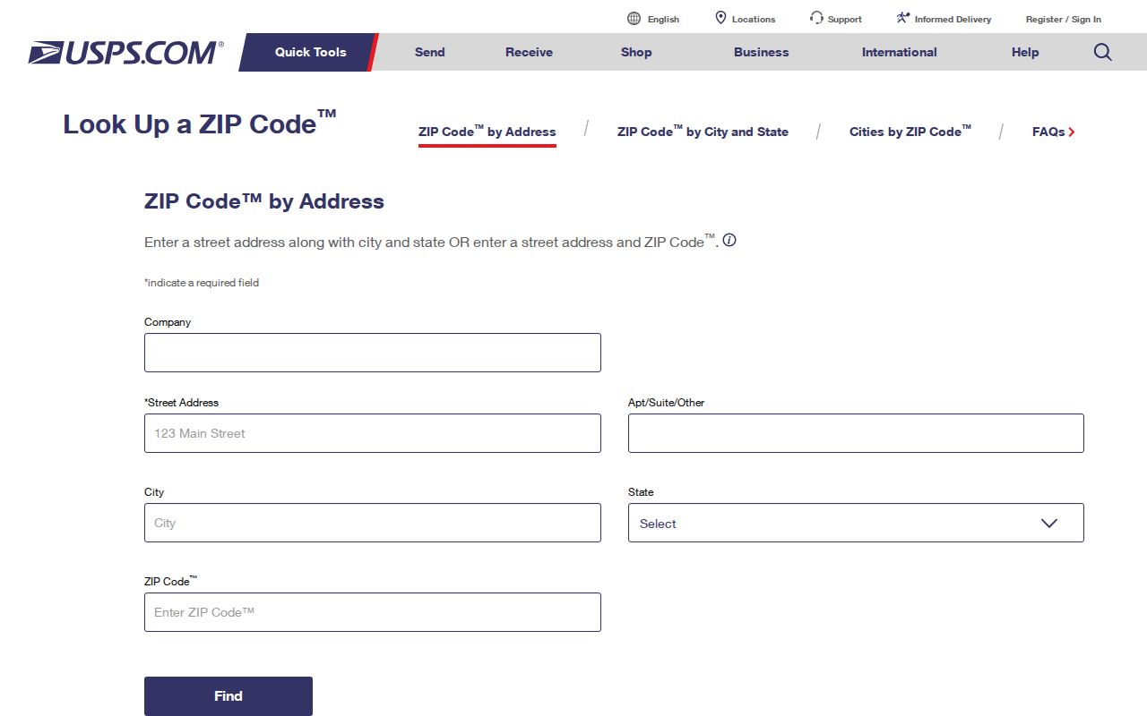
The image records the USPS lookup route, not a ZIP population, post-office name, or city boundary. Those questions need separate official evidence.
Note: The USPS result validates delivery for the entered address; it does not establish city limits or identify a records custodian.
Bell Gardens Assessor ZIP Layers
The Los Angeles County Assessor Portal accepts Basic Search by AIN or Address, plus Legal Search and Map Search. AIN means Assessor Identification Number: a ten-digit key combining map book, page, and parcel, displayed as 1234-567-890. Use Address when autocomplete works; use Legal or Map Search when it does not.
| Assessor control | Mode | Input or action | ZIP use |
|---|---|---|---|
| Basic Search | Tab | Choose AIN or Address | Starts an address or parcel check; not a ZIP-wide owner search |
| AIN | Text | Find AIN using ten digits | Links the parcel across map, assessment, recorder, and tax research |
| Address | Autocomplete | Enter the physical or situs address | Tests the exact parcel location behind a postal label |
| Legal Search | Tab or form | Use the assessment legal description | Fallback when address autocomplete fails |
| Map Search | Map or tab | Pan, zoom, click a polygon, then get parcel detail | Compares parcel placement with ZIP and city layers |
| Map layers | Menu or checkboxes | Parcels, cities, communities, ZIP, districts, and aerial years | Shows overlap; it does not create a resident list |
The Los Angeles County Assessor Parcel Viewer has a separate map role. Layers include parcels, cities, communities, ZIP Codes, Tax Rate Areas, districts, street labels, and 2008 through 2023 plus selected 2024 and 2025 aerials. Layers show overlap, not resident lists. The portal has no broad owner-name search; results expose AIN, situs, parcel or use, status, tax and exemption data, improvements, ownership-event metadata, and values, but not a ZIP-wide owner or resident list.
From Bell Gardens ZIP to AIN
The AIN translates a ZIP clue into parcel research. Situs is the physical parcel location; a mailing address is where tax correspondence goes; a legal description identifies land. A PO box or out-of-city mailing address does not move the parcel, and 90201 does not prove Bell Gardens jurisdiction.
Use AIN as a land and records key, not a person claim. Ownership events can show date, sequence and document number, type or reason, codes, parcel count, interest, and verification code. Filters include “Show Re-Assessable Only” and “Show Subject Parcel.” Current owner or tax mailing was not found in deployed labels, and no owner-name search was provided. Ownership does not prove occupation. A Homeowners’ Exemption, labeled HOX, may suggest owner occupancy but not identify renters or household members.
Research chain: exact address to assessor situs, ten-digit AIN, Parcel Viewer layers, then the county or city custodian for the selected record. The ZIP helps start the chain. It does not replace the chain.
Note: Parcel identity can connect records across offices, but parcel ownership and residence remain separate questions.
Finding Bell Gardens Residents by ZIP Code
No official ZIP-keyed resident result exists for 90201. Narrow the postal area to an address or record type, then judge what each result confirms. Assessment data locate parcels. Voter verification can confirm one requester’s registration. Recorder workflows can supply instruments after a parcel or name is known. None is a ZIP-wide resident directory.
Use the following order when a Bell Gardens ZIP Code is the starting clue:
- Verify delivery. Run the exact street address through USPS by-address lookup, using the city name that belongs to the address.
- Locate the parcel. Search the Assessor Portal by Address or AIN, then use the Parcel Viewer ZIP and city layers to check placement.
- Choose the jurisdiction. Compare the parcel and municipal line before selecting a police, planning, permit, or records custodian.
- Use voter verification narrowly. The Los Angeles County verifier requires last name, date of birth, house number, and ZIP Code. It verifies the requester’s own registration, not a public by-street list.
- Move to the right record office. The RR/CC has no ZIP or address search for recorded instruments, so use its real-estate request path after an AIN, name, year, or document clue is available.
This sequence keeps a postal match from becoming an unsupported resident claim. Once a 90201 parcel is tied to a named street, the Bell Gardens street directory can take over the street-level record chain.
Bell Gardens ZIP Boundaries vs City Limits
ZIP and city lines answer different questions. 90201 includes Bell and Bell Gardens. Parcel Viewer displays cities, communities, parcels, and ZIP Codes side by side; Assessor search starts with address or AIN. RR/CC has no ZIP or address search. Voter verification accepts ZIP only with name, date of birth, and house number. A postal query therefore cannot choose the police, planning, permit, or records custodian.
Use the city and county trail: municipal parcel and planning for the city line, Assessor for parcel identity, RR/CC for legal instruments, and voter verification for your own registration. If labels conflict, preserve the city, parcel map, and ZIP result rather than forcing one label to answer every question.
ZIP is not a city boundary. A 90201 mailing label can point to Bell or Bell Gardens. Confirm the municipality before treating a ZIP match as a local records match.
- ZIP code
- A five-digit USPS delivery area. It groups addresses for mail service and does not define a city, parcel, or household.
- ZIP+4
- The five-digit code plus four digits that narrow delivery to a smaller route segment. ZIP+4 adds postal detail without changing municipal jurisdiction.
- PO-box ZIP
- A code used for post-office box delivery rather than a geographic street area. No Bell Gardens PO-box-only ZIP was verified in the official static sources.
- Unique ZIP
- A code assigned to one organization or facility. No Bell Gardens unique ZIP was verified in the official static sources.
- Carrier route
- A postal delivery route grouping used for sorting and route work. It is not a city boundary or a resident roster.
Note: A five-digit match can narrow a search, but only an address and parcel check can anchor the municipality.
Pre-1961 Bell Gardens Place Names
Bell Gardens incorporated on August 1, 1961. Earlier residents and parcels appear in Los Angeles County, ranch, precinct, or neighboring-place records rather than a Bell Gardens municipal series. Rancho San Antonio and the Lugo family matter because its land became Bell Gardens, Maywood, Vernon, Huntington Park, Walnut Park, Cudahy, South Gate, Lynwood, and Commerce. Modern city names are not safe search terms for every older record.
The Bell Gardens local history chronology links the Gage Mansion site to the land trail. Its adobe was built in 1795; 7000 Gage Avenue became California Historical Landmark No. 984 in 1991. Legal descriptions or grant history can be more useful than modern street labels when older parcel evidence is hard to match.
Bell Gardens covers about 2.4 square miles; Rancho San Antonio covered more than 29,514 acres. No official street-renumbering event was located. Test a missing old address against subdivision and parcel maps, directory scope, and historic maps before calling it a renumbering. Older land research still rests on parcel and legal description.
Bell Gardens ZIP Research Gaps
Some ZIP facts remain unverified and should stay unverified. No official static source supplied a post-office name, PO-box or unique status, realignment history, or ZIP population. The source set confirms 90201 for inspected Bell Gardens and Bell library addresses and found no second Bell Gardens ZIP, but it does not support a station name, split year, or population estimate. Do not treat a missing field as proof that USPS has no dynamic record.
Document a gap with the source, precise question, access date, and next official check. For 90201, preserve civic addresses, the USPS URL, and the Assessor ZIP layer. Separate fact from inference: Bell and Bell Gardens share the code; that complicates jurisdiction; static sources did not identify station, realignment, unique or PO-box status, or population. Replace a gap only when official evidence appears.